Wednesday, March 30, 2011

Archaeological site (Pakistan) Banbhore


Banbhore


Banbhore is an archaeological site situated on the Northern Bank of Gharo Creak, at a distance of about 64 km east of Karachi on a road leading off national highway. The signboard marked “Banbhore Site” is located on main road. This site has great importance in foundation of today’s Muslim state of Pakistan. It is an ancient site through which Islam entered the sub-continent when Mohammad Bin Qasim invaded it. It was here that the Muslims first set their feet on sindh and where the religion Islam entered to Indian Subcontinent in 712 A.D.

                                                          
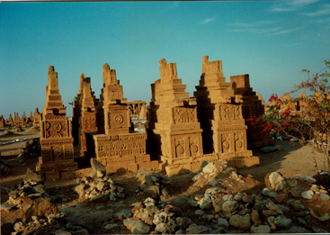
Banbhore is more than 2,100 years old. . Banbhore covers a considerable area and overlooks a creek that winds its way to sea .Banbhore was once a busy port. This port was center of trade. It can be guess from that near the water the battered remains of sandstone steps still survive.  Around the 10th century Banbhore was the capital of a chief Bamboo Raja and was named Bhambor after him. The city was later destroyed in 1250AD. Some scholars identify Banbhore with Daibul, the port city where the 17-year-old Arab Conqueror Mohammad Bin Qasim landed in 712 AD. He was son-in-law and also a general in the army of Hajjaj Bin Yousuf. Hajjaj Bin Yousuf was the governor of Iraq and was known for his strict administrative qualities. At that time Sindh was ruled by Raja Dahir.

Hajjaj send army under the leadership of Mohammad Bin Qasim who was only 17 at that time. He attacked India and laid a strong siege around Daibul, which was the strong fortification of Hindu armies. A catapult (manjaniq) known as Al Aroos was used to dislodge the Hindu armies. Eventually Daibul was conquered and Dahir was killed. Mohammed Bin Qasim then occupied the delta towns, marched north up the Indus and within a few weeks reached Multan.

          
The first mosque of South East Asia was also built during this period. After the young general conquered the city, Muslims built more mosques, other residential buildings and fifteen walls around the town. Although only ruins are remain of this remarkable city, but the styles of buildings, road networking and drainage system shows the high level standard and vision of people of the area possessed.


The remains of the site include a mosque with numerous Kulfic inscriptions carved on stone slabs. This was first mosque of South East Asia, the bricks which have been used are very modern and remain cool in summer and become hot in winter. A Hindu temple of the pre-Muslim period had also been unearthed along with coins belonging to the Khilafat period. Other stone, glass and ivory objects, pottery, jewellery , arms and some human skeletons with arrows in heads show that this town to violent end.
The pieces of pottery found by archaeologists are similar to those found in Taxila and known to be of the 1st century B.C. Until the 8th century A.D, the city was controlled by Buddhists and than the Hindus. Than Arab came and ruled.


Banbhore is beautiful site with a small museum. This museum traces the history of the port. It has a good display of pottery of various types. Just after entering the museum you can find a model map of Banbhore enclosed in a glass case. The museum also displays pottery, china ware, beads, coins and many other articles used by the people of this ancient land. When we walk around the museum we learn that Banbhore was a well-planned and advanced city. The people had nice tools and equipments to cope up with the daily challenges. For cooling the water, they had a mud-clay-cooler with a long stem at the bottom of the same material. The stem was used to fix in the sand, which kept the water cold. You can also find toys, needles, buttons, etc.  A catapult (manjaniq) used for battle is place outside area of the museum.

Banbhore was excavated in 1962. History told that Banbhore was first inhabited by central Asian Sythians and Parthyans, later Alexander the great conquered this place and established a town in 325 BC. This city became the last conquest of Alexander the great f from where he went back westwards and died on his way to Iran. Then the first Muslim conqueror in South East Asia came in 712 AD.


Banbhore is also associated with the famous romance of Sassi and Punnu. Sassi belonged to Banbhore, but their graves are in “Othal” in Balochistan.
                                                   

There is also a small lake and a shady picnic area and a rest house. There are many guides appointed by the Pakistan government who provides information to the tourists about Banbhore, which is now a strong archaeological heritage of Pakistan. Banbhore is a perfect excursion place to see the ancient history and cultural heritage of Pakistan. Yet now they are not much in this site. However, even then a lot can be learned from this place.

Friday, March 25, 2011

Ziarat Tourist Resort (Pakistan)

Ziarat, Baluchistan (Pakistan)

Ziarat is a famous and best holiday resort of the province of Baluchistan (Pakistan). It is the capital of Ziarat District, Baluchistan and is located at 30°22'47N 67°43'38E with an altitude of 2543 meters (8346 ft. Ziarat is the soul of Balochistan.It is a place of juniper forests, lush green valleys, cascades, hills and orchards.
Ziarat situated 133 kms from Quetta. A trip to Ziarat from Quetta can be made by two routes one by the single road, which though a short-cut, is very difficult but full of fun and excitement for the hunters. The other is the Karachi- Quetta -Ziarat Road..After traveling over 43 miles of the ragged country side one reaches Kachh where, besides a few tea shops, there is a Rest House equipped with necessary facilities. Thereafter a 33-mile long hilly track takes one to the green valley of Ziarat. This part of the journey is quite interesting and one comes across lofty hills covered with a thick juniper, patches of green fields and clean and cold water springs. Comfortable Hotels and motels are available in Ziarat. Most of the Hotels are situated in the heart of this picturesque town. There rooms are comfortable and some are surrounded with the lawns. There are restaurants and local places that cater to both local and western tastes. Some Motel also offers Rent-a-Car, Satellite TV, Telephone, Fax and Laundry services. There is bank facility as well. The people are generally sturdy and very hospitable. The local dish of Ziarat is Saji. Saji is a delicious traditional food. Pushto, Persian, Baluchi and Brahui are the local languages. Urdu and English are also spoken.


Ziarat is also very famous for its juniper forest. The junipers are considered to be the real treasure of Ziarat.It is the second largest Juniper forest in the world, which covers an area of about 247,000 acres (1,000 km2). Ziarat is covered with juniper trees, thickest on the north, south and east sides. There are trees in the valley which are more than 5000 to 7000 years old. Juniper trees are very rare. Junipers are one of the slowest growing trees in the world. They grow one inch in a year. Average age of the extremely slow growing juniper trees is 300 years. Juniper berries are used as flavor. Oil is extracted from these trees which has a number of uses. Junipers provide shaded walks and hilly tracks in different directions of the valley. Every walk unfolds a singular spectacle of exceptional scenic beauty. People living in the Juniper Mountains possess a rich indigenous knowledge of the local plant resources.

Beside Juniper other major species of trees include Wild Ash; Wild Almond; Olea species; Khujak. Ziarat is also famous for its sweet apples, black and red cherry. Shinshoab' a lavender-like wild bush, looks lovely in twilights.

In Ziarat, an herb called Ephedra sinica is found in abundance from which a chemical called ephedrine is extracted, an important constituent of various medicines, especially cough syrups. There are many important species found in this ecosystem including animal and birds, the Chakor partridge, bushes and ground flora which local people use these plants as indigenous treatments for a variety of diseases. Other Medical herbs like Artimesia and mint etc are also produced. . A wide variety of flora and fauna are found here. The valley is known for its honey and the extra ordinarily large flowers. Fragrant lavender hushes cover almost the entire landscape from July to October.

Ziarat is best place for trekking and mountaineering. Local people are very co-operative and guides are easily available. Following are famous Places to visit:

Quaid-e-Azam residency’s visit is very basic sightseeing of Ziarat. A visit to Ziarat is incomplete with out it. Basically Ziarat is famous for the reason that Mr.Jinnah, the founder of Pakistan spent the last few days of his life there. Quaid-e-Azam stayed in this residency for about three months from June to September, 1948. Ziarat takes pride in hosting Quaid-e-Azam Muhammad Ali Jinnah, on a number of occasions. It is because of this reason that the small double storey Ziarat Residency has won the position of a national monument.

The residency is embellished with beautiful lawns, covered with grassy carpets and with roses, beautiful flowers and other plants all around the garden. From there one can have a striking view of the picturesque valley. From the balcony of the upper floor, as well as from the lawns down below, the entire valley panoramic view is seen.
There are two shrines. The first and famous shrine is of Baba Kharwari, which is 8 km from Ziarat town. The name Ziarat means 'Shrine ' is derived from the name of Baba khawari’s shrine. He was a famous Muslim saint. His real name was Mian Abdul Hakim, popularly known as Mulla Tahir and Kharwari Baba. According to a legend, this Saint came here from Khandahar (Afghanistan). He opposed the highhandedness of Ghlzai King Hussain. He was than forced to leave his native town and migrated to this place. On reaching this valley he took abode on a hill top and prayed for this place saying: "This place shall flourish". Thereafter water started coming out from the spot which is still flowing and is regarded as holy and wholesome. During the Eid festival, the tribesmen gather around the shrine and hold wrestling and marksmanship competitions. The journey to Shrine of Baba Khawari is very beautiful and full of breath taking views of the valley, offers lot of places for trekking.


Another shrine is of Nau Gaza Baba is 1 km from Ziarat town. It is surrounded by big graveyards. Nau Gaza Baba's real name was Kareemdad. He was a member of the 'Esakhail Sanerzai' tribe. When he died, his body became large by nine (Nau) yards (gaz) therefore people started to call him Nau Gaza Baba. Many people visit the shrine to pray.
Prospect Point is an excellent picnic spot situated 6 km from Ziarat. There is a jeep able road but those who want to enjoy the scenic beauty at leisure can have a walk. The road which passes through the lofty hills and deep ravines overlooks the valley, about 1000 feet below, covered by the ever-green juniper trees. There is a newly constructed Rest House from where one could have a wonderful view of the valley particularly during the rainy season. Down below in the valley is the shrine of Kharwari Baba. 'Prospect Point' offers breathtaking view of the valley.

Khilafat point is 3487 meters high. Its snow capped peak offers tourists for its enchanting view. But the route is quite difficult. Once reach there the trip is rewarding. The valley is beautiful. It seems a view of heaven.


There are more than a half dozen gorges around Ziarat formed by natural karez spring water falling through narrow opening amongst the mountain rocks producing a dramatic effect Tourists usually visit these gorges for picnics and to enjoy the falling water through Rock Mountains. A walk to Chashma is popular amongst joggers and those who wish to have a pleasant walk.
Tangi Sandaman is just 4 km from Ziarat.  It is a small village and union council of Ziarat contains a dramatic waterfall cascading down the rocks which is an attraction for visitors. People traveling to Ziarat can make a small diversion to the left, 4 to 5 km short of Ziarat and witness this amazing waterfall-cum fountain.

 The another famous gorges along the road to Ziarat is Chutair Tangi  There is also a rest-house in case one wants to stay longer.Going on the road past Ziarat, travel for almost 20-30 minutes and then after a few small restaurants, turn left, the road leads straight to Chutair Valley and Chutair Tangi.On entering this place, you’ll see the mountains start forming the tangi. A walk for almost 4-5 minutes after the first point and the main part of the tangi starts. Water flows in between two large cliffs which closely surround it. It goes a long way and you can also rest and eat here, under the shadow of the cliffs. If you’ve seen 127 Hour, it’s something close to that but very safe. Try going on working days as there will be less people around. This place is open all the time and also available for camping.


Fern Tangi 10 km (20 minutes by jeep) from Ziarat, off the main road to Quetta. A small waterfall formed by the mountain spring flows down. It is 2 km walk from the main road to the waterfall and is an ideal place for picnics.


Other Gorges are Kahn Tangi and Kawas Tangi. The sound of waterfalls singing to the tune of solid rocks while passing through narrow gorges creates a mystic atmosphere. One can approach easily to these gorges by diverting from the main. Besides these, places to visit are Zindra (Fourteen kilometers from Ziarat and Mana lake etc. Zizree is 16 kms from Ziarat.


Kawas is the largest village of the district.. The mini dam is Kawastangi storage dam located in this village.


Tourists visits Ziarat to seek comfort in its cool, pleasant climate. Although it is quite cool and soothing in summer, with the beautiful views of apple and cherry gardens. But winters are severe with heavy snow fall that covers entire place gives the view that is not available in summer. When the snow falls, the juniper valley is at its most beautiful. Tourist season is throughout the year but more tourists visit during summer. Best time to visit is from May to October.

Thursday, March 24, 2011

CHAUKUNDI(Pakistan)

Archaeological site (Pakistan)


Chaukundi Tombs

Chaukundi is located at a distance of 27 kms from Karachi (Pakistan) on
National Highway.It is a famous ancient graveyard. It is around 600 years old ancient site, attributed to Jokhio and Baluch tribes. The distinguish features of these tomb graves is its marvelous carving and engraving with various designs.


The Chaukhandi graveyard spreads over an area of two square miles and contains tombs of certain warriors of Baloch families settled in this area some time during the 17th and 18th centuries A.D. Chaukundi  means four corners, which is due to its stepped rectangular shape. The tombs are two and half feet wide, 5to 8 ft long and 4 to 14 ft high. 

The tombs are built of yellow sand stones. This extraordinary work is masterpiece of handmade craft. The entire tombs are craved with geometric designs that cover the whole surface. The design and color composition of slabs are very impressive. The intricate carving in geometric designs is unique and its delicacy carving gives the impression of wood carving. This unique style has made this graveyard a place as art gallery for artistic mind persons.

Those who create this pattern and design must be highly skillful persons and must have aesthetic sense.  It is the reason that after so many years these carving designs are still popular in different medium of art. These designs are very delicate and elegant.


The designs and pattern on these Tombs indicates the status and the difference between men and women graves. Mostly the Canopy tombs are of chiefs of the tribe.  The inner side of the roof is carved in spiral pattern. The tomb slab of women are embellished with design of jewelers such as earrings, necklace, rings, anklet, bracelet and pendent etc. The men tombs are carved with design of turban style pattern, carved with arms and weapon, horses and their riders. The tombs also contain floral and abstract designs. There are thousands of varieties of these exquisite design carved on slabs of tombs.

It is interesting to mention, that these tombs’s carving designs and patterns are widely use these days in almost every field of art and craft. These designs are highly valuable and extreme popular in jewelers, textile, pottery, wood, clay or just plain paper.

Due to its delicacy of carving and engraving work and it is importance as an archaeological site, Government of Pakistan printed these Tomb’s floral pattern on 100 rupee currency note. The floral print is on the both sides of the note. This indicates the importance of this place.

Chaukundi Tombs are like gold mine for artist, designers, architects, crafters and all those are associated to art industry. It is not only our archeological treasure but it also serves as learning institute. Not only the sightseeing astonishes the viewer but also thousand of designs idea can be generate from these carvings. It is best site for creative persons.

Chaukundi is our national treasure. The graves are the masterpieces of stone carvings. We should realize its importance and its beneficial uses in almost all aspect of creativeness. We should work for its preservation and be always thankful for having such a beautiful archaeological place in our country.

Monday, March 21, 2011

MOEN-JO-DARO

MOEN-JO-DARO

Moen-jo-daro’s archaeological Ruins are located in the District Larkana, province of Sindh (Pakistan). Moen-Jo- Daro is located in on the right bank of the Indus River at a distance of about 27 km from Larkana, 107 km from Sukkur and 400 Km from Karachi. It lies on 27o 19' 30.36" North latitude and 68o 08' 08.77" East longitude at an elevation of about 164 ft from sea level.


This archeological site is 5000 years old. It was a city of the Indus Valley Civilization built around 2600 BC. It flourished for about 800 years during the 3rd and 2nd millennia BC. The Indus Valley Civilization was one of the world's first great urban civilizations. It flourished in the vast river plains and adjacent regions in what are now Pakistan and western India. This ancient city is widely recognized as one of the most important early cities of South Asia and the Indus Valley Civilization. The Indus Valley was home to the largest of the four ancient urban civilizations of Egypt, Mesopotamia, India and China. Moenjo Daro was one of the world’s first cities and contemporaneous with ancient Egyptian and Mesopotamian civilizations. It is sometimes referred to as "An Ancient Indus Valley Metropolis".


The meaning of Moenjo-daro is the Mound of the dead. Moenjo-daro was discovered in 1922 by R. D. Banerji, an officer of the Archaeological Survey of India. Of this vast urban ruin of Moenjodaro, it is estimated that the ancient city of Mohenjodaro once occupied an enormous area of four square kilometers only about one-third has been reveal by excavation since 1922. Most of its ruins, including major cities, remain to be excavated. Moenjo-daro is highly complex culture. The site is under the protection of the Department of Archaeology and Museums, Government of Pakistan.


The ancient city was surrounded by a fertile flood plain suitable for seasonal agricultural and grazing land, abundant wild game and fish as well as considerable wild plant resources. In the absence of extensive irrigation systems this diverse resource base and economic networks linking the cities to regional production centers is thought to have been an important factor in the rise and survival of such large cities.

Various factors contributed to the decline of Mohenjo-Daro On the one hand, changes in the river flow patterns and correspondent widespread flooding would have disrupted the agricultural base, but did not destroy the city directly.

Although there appears to have been a significant break between the end of the Indus occupation and the Early Historic occupation, it is unlikely that the site was ever totally abandoned due to its high position on the plain and the protection it afforded against floods.  


Moen-jo-daro comprises two sectors: a stupa mound that rises in the western sector and, to the east, the lower city ruins spread out along the banks of the Indus. The acropolis, set on high embankments, the ramparts, and the lower town, which is laid out according to strict rules, provide evidence of an early system of town planning.


The stupa mound, built on a massive platform of mud brick, is composed of the ruins of several major structures - Great Bath, Great Granary, College Squareand Pillared Hall - as well as a number of private homes. The extensive lower city is a complex of private and public houses, wells, shops and commercial buildings. These buildings are laid out along streets intersecting each other at right angle; in a highly orderly form of city planning that also incorporated important systems of sanitation and drainage.


Moen-jo-daro was built on a rectangular grid with broad roads several meters wide running north to south From these main roads, side streets and smaller service lanes created a systematic web providing access to every house in the city block, and each was connected to an underground drainage system windowless outer walls, a style till practiced in these desert areas to prevent hot dusty air from entering the homes. Many of the houses are two or more storey high, in typical brick and timber construction still in use today. The baked bricks used for construction are of a regular standard size.  The plans of the houses are different but have areas for bathing with drainage and living spaces, often with a central courtyard within for domestic privacy and housework. Stairways lead up to the roof (which no longer exists) but must have provided, as indeed it does in many homes today, a place in which to sleep and rest during the cool nights of summer.
The narrow lanes kept the sun out and keeping them relatively cool in extreme hot weather.


Important crafts were carried out in different sectors of all the major mounds and include copper working, shell and ivory carving, lapidary and stone tool production as well as many different types of furnaces for the manufacture of terracotta pottery, stoneware bangles, glazed faience ornaments and fired steatite beads. The shapes and sizes of the pottery give some indication of their use: enormous storage pots a meter or so high, tiny little vessels that look like a child's make-believe kitchen set, pots for cooking, serving, and small-mouthed containers for oils and precious liquids .There are hundreds of clay toys for children of animals, bullock carts, and of people at work which provide an animated account of life in the ancient metropolis. Large collections of wheel-thrown pottery finely worked with a red and black slip, with designs and motifs of birds and flowers are a lively heritage of the past. Few rare discoveries were made of gold and silver ornaments and silver vessels that provide evidence for a class of wealthy merchants or landowners. Different styles of ornaments and headdresses on the human figures suggest that many different classes and diverse ethnic communities inhabited the city.
             

Most intriguing are the seals some steatite (a kind of soft stone) ones bear inscriptions and beautiful carved figures of animals, of humped bulls, unicorns, tigers, and strange men wearing bull horn masks and seated cross-legged on a throne and writing. Seal manufacturing workshops have been discovered in very restricted locations indicating strong control of production. The recovery of seals has confirmed that the people of the Indus Valley had trade contacts with their contemporaries in Mesopotamia. The seal were used by traders to mark their goods before sale and export, some probably used as family insignia or a religious talisman
          

While the script on seals are still an enigma and has not so far been deciphered. Not much is yet known about the religious of the people of Moen-jo-daro and basic questions about the people who created this are unanswered. It may perhaps have been a wonderful culture which had no formal religion; a truly liberal people who, unlike us, spent little time and resources on warfare, on arms and weapons, and the destruction of others; who instead crafted their valuable supply of metals to make tools, jewelry, and exquisite masterpieces of sculpture and on building well-planned cities that attracted thousands of people to come and live and partake of their sophisticated culture for centuries.


The important point is that still the same bricks are use for constructing houses with similar pattern. Despite this culture was 5000 years old but planning of town is much better than today’s construction. Our society having being advance and modernization life style we have adopted. still we are not better than this 5000 years old civilization.