Friday, May 17, 2013

Thanda Dam (Khyber Pakhtunkhwa Province - Pakistan)


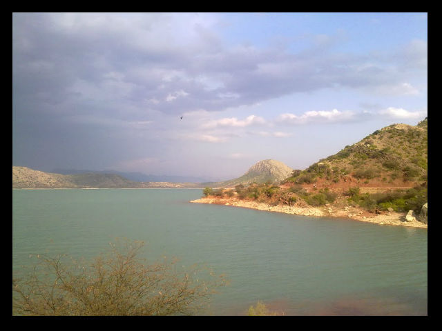
Tanda Dam is located in Kohat District in Khyber Pakhtunkhwa province of Pakistan. It was built in 1960s near Kohat city. Tanda dam is a medium sized man-made dam to supply water and electricity to the region. 


The dam is used for irrigation, fisheries and picnic which is constructed on the water of Kohat Toi River. At Kagazi village, river water is diverted towards Tanada dam.Although most of the shoreline is steep, stony and devoid of aquatic vegetation, at the west end there are some areas of gently shelving muddy shores with a small amount of emergent vegetation


 It is the main source of irrigation to adjoining areas. Agricultural lands from Tanada dam up to Jarma and Dohda Sharif are irrigated where vegitables, weat and sugar cane are cultivated


 Tanda dam and its surrounding area  is very beautiful. 

Thursday, May 16, 2013

Trakker Tower- Karachi

The Trakker Tower at Korangi Road Karachiis a prestigious office tower development. It comprises of a single, 29-Story building structure with a covered area of 350,000 sqft. The first eight floors are reserved for parking with the upper 20 floors for corporate office space.


Tuesday, May 14, 2013

Hispar Pass

Hispar Pass

Hispar Pass (or Hispar La) (el. 5,128 m./16,824 ft.) is a high-altitude, non-technical mountain pass in the Karakoram Range in Pakistan.The crossing point between  Hunza valley and Baltistan is the Hispar pass which is at the elevation of 5151 meters.


At the pass, the Biafo Glacier (63 km. long) and Hispar Glacier (49 km long) meet to form the world's longest glacial traverse outside of the polar regions, 100 kilometers in length.


Hispar Pass is surrounded by  nameless and unclimbed peaks.  One of the highest peak in east is the Baintha Brak 7285 meters high. In the west the Hispar glacier forceful and snow covered stretches down as far as the eye can see, Separating the Hispar Muztag range on the right from the Rakaposhi and Balchish range.At the base of Hispar Pass on its eastern flank rests Snow Lake, a basin of ice (16 km. wide) surrounded by granite pinnacles yet to be climbed.


Hispar Glacier

Hispar Glacier  is situated on the southern slopes of the Karakoram Range in the Baltistan area of Ladakh of Pakistan. Hispar Glacier is a 49 km (30 mi) long glacier and is the third largest glacier in the Himalayan region.

It  meet the 63 km (39 mi) long Biafo Glacier at the Hispar La (Pass) at an altitude of 5,128 m (16,824 ft) to create the world's longest glacial system outside of the polar regions. This 100 km (62 mi) highway of ice connects two ancient mountain kingdoms, Nagar (immediately south of Hunza) in the west with Baltistan in the east.

Numerous smaller glaciers join the main glacier  The central portion of this glacier is a vast snowfield while its sides contain debris eroded by the huge body of moving ice. The entire tract is completely lacking in vegetation of any kind.

The extreme steepness of the hillsides and strenuous nature of the boulder hopping on the lateral moraines and hillsides make this route's upper half the most difficult part of the Biafo - Hispar traverse. Only the Hispar La day includes walking on the Hispar Glacier. The crossing of four major tributary glaciers from the north is most taxing, and potentially high nullah crossings can be dangerous.

The views of 7,800-metre (25,600 ft) peaks and of the snow covered cliffs and mountains on the south side of the glacier are particularly impressive.


The Hispar River, a tributary of the Hunza River, rises from the meltwater of the glacier.A very large glacier feeding the main stream of the Shigar River, which in turn drains into the Indus River.


Babusar Pass


Babusar Pass


Babusar Pass or Babusar Top (4173 m./13,691 ft.) is a mountain pass at the north of the 150 km. (93 miles) long Kaghan Valley connecting it via the Thak Nala with Chilas on the Karakoram Highway (KKH).


The mountain ranges which enter Mansehra district from Kashmir are the offshoots of the great Himalayan system. In Kaghan valley the mountain system is the highest of the area including the Babusar top. This range flanks the right bank of the Kunhar, contains a peak (Malika-e-Parbat) of over 17,000 feet (19), the highest in the district.


On the mountains the grasslands are also found where Gujars and other nomads migrate during summer for grazing their sheep, goats and other animals. On the northern side there are mountains which are the extension of the same mountain system as that of Kaghan mountains. This range diverges from the eastern side at Musa-ka-Musalla a peak (13,378 feet) (20), which skirt the northern end of the Bhogarmang and Konsh valleys, and sends down a spur to divide the two. Here thick forests are found especially on the higher slopes. 


It is the highest point in the Kaghan Valley.The Kaghan area can be access by road via the towns of Balakot, Abbottabad and Mansehra . The Kaghan Valley is at its best during summer. Best time to visit is from May to September. From the middle of July up to the end of September the road beyond Naran is open right up to Babusar Pass. but it  is restricted during the monsoon and winter seasons.

Monday, April 15, 2013

Parachinar

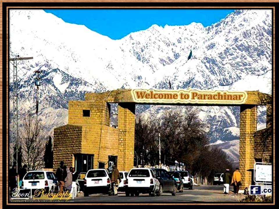
Parachinar is the capital of Kurram Agency, and the largest city of the Federally Administered Tribal Areas of Pakistan. 


The name Parachinar comes from a big Chinar tree (Maple tree) at a place. A tribe known as the Para Chamkani, used to convene their meetings under this Chinar tree to resolve their social matters. So that's how this city named as Parachinar. The old name of Parachinar is Tutki, when Kurram was a part of Afghanistan. The inhabitants of Tutki are called Tutkiwal, the Afghan people call it Tutki


Parachinar is situated on a neck of Pakistani territory south of Peshawar, that juts into Paktia Province of Afghanistan. It is the closest point in Pakistan to Kabul and borders on the Tora Bora region of Afghanistan.
Parachinar has a moderate humid subtropical climate  with much higher rainfall than most areas of Pakistan  During the winter, snowfall is common, and frosts occur on most mornings. Snow closes the Peiwar Pass, located on the Paktia border just over 20 km west of Parachinar, for up to five months per year.


The population consisted of largely pashto speaking Syed, Turi, Bangash, Orakzai, Mangal, Para Tsamkani, Zazai, Malekhel, Ghilzai, Muqbil, Hazara, Khoshi and as well as a Sikh community. Turi, Bangash, Orakzai, Zazai, Mangal and Para Tsamkani are the major tribes in Parachinar.


The principal mountain range in the agency is the Koh-e-Safaid or Spinghar with highest peak of Sikaram Sar 4,728 meters height which forms a natural boundary and water shed with Afghanistan. It remains covered with snow through out the years. 


South of the Peiwar Kotal the hills of the Mandher range rise gradually till they drop the south–west corner of the plateau at Kharlachi, the point where Kurram River enters the valley. Parachinar is a big market for the people of surrounding areas. It is also famous for timber and dry fruits. 

Parachinar Airport is located at about a 25 minute drive from the center of Parachinar, FATA Pakistan. It is the only airport in FATA that is served by any passenger airline

Zeran Dam
Zeran dam is located to the north-east of Prachinar. It is also famous for its scenic beauty. This reservoir served water for Parachinar town before the construction of Malana dam, still the dam contributes much water to a large part of the town Parachinar.

Malana Dam 
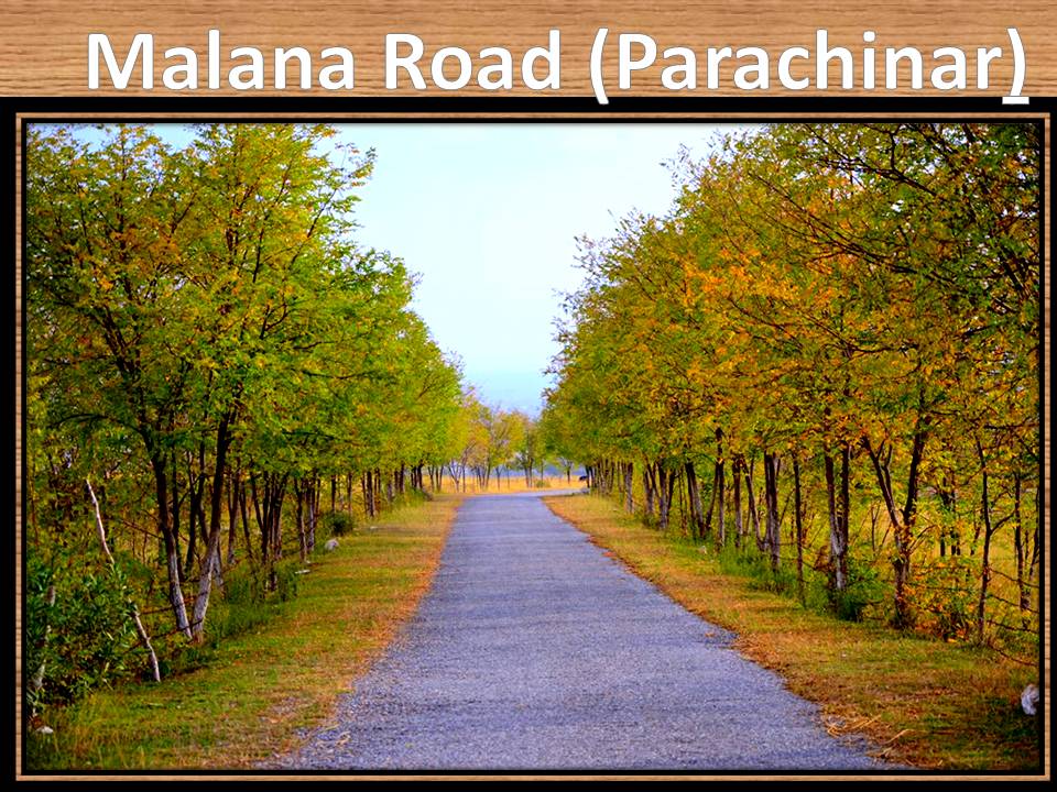
Malana Dam is located in the north of Parachinar town. Most of the population of Parachinar town depend on this reservoir.It is famous picnic resort .A guest house is built here.

Friday, April 5, 2013

Khalti Lake (Ghizer District- Gilgit ,Baltistan)

Khalti Lake is located in District Ghizer, Tehsil Punial. Ghizer District is the westernmost part of the Gilgit-Baltistan region of Pakistan. There are so many villages lush green and very pleasant places in Ghizer District. The most spectacular view and biggest Lake is  Khalti lake which  is very famous for trout fishes.It is one of the four lakes of Ghizar District.


Khalti lake is located about 110 KM from Gilgit towards Shandoor its a lake called . In winter it get extreme cold and the lake get frozen .


Khalti Lake is merely an extension of the Shandur river. The water is calm. It takes over It is 20-30 minutes drive from Gupis.


Phander Lake (Gilgit- Baltistan)

Phander Valley is in Ghizer District of the Gilgit-Baltistan region of Pakistan. It is one of the most scenic valleys with easy access both from Gilgit and Chitral. It is located  163 km from Gilgit city and 61 kilometers (38 miles) from the valley of Gupis.  It is a  Small villages which lies on the way to Shandur pass.from Gupis..


Phander Valley is one of  the most beautiful valley in Pakistan..It offers spectacular scenic view.. It is very lush green and very pleasant place. A twisting road passes through lush green fields and forests with a view of flowing river and icy peaks  lead  to this charming valley. From springs of crystal clear waters to lakes and rivers of deep blue water, there are all colors of nature’s beauty in Phandar Valley. Peaceful deep blue waters of River Ghizer and surrounding lush green and golden fields are breathtaking. It takes 5 to 6 hours from Gilgit to reach Phander valley


There is a lake at the eastern end of the valley  named Phander Lake. Phander Lake is one of the most famous tourist spots in the entire region. . The  Phandar Lake gives  masmerizing views. The deep blue of  Phander lake offers a magnificent view. It is  very famous for trout fish . Area of Phandar Lake is about 3 kilometers. To reach Phander Lake one has to cross Phander valley from the river to the right and climbs a hill. 


The people of this valley are simple,hard working and very hospital. Best season to visit  Phandar valley is between June and July  Days stays fair and warm and nights are a little cold.