Friday, February 5, 2016
Monday, January 11, 2016
Pattoki “The City of Flowers
Pattoki also
called “The City of Flowers” is a town in the Kasur District of the Punjab
province of Pakistan. It is located at an altitude of 186 metres (613 feet).
Pattoki is famous for its flowers. It was declared as
"Queen of Flowers" by Queen Elizabeth because of the largest Flower
Market in the region It is the only one city in Pakistan that have flower market mainly for roses.
Pattoki has
excelled in flower cultivation. Roses are one of the leading cut flowers. Jasmine,
gerbera, carnations, chrysanthemums, tulips, poppies and orchids are some of
the varieties produced in Pattoki
Prime
quality and yield is achieved between October and March, and domestic and
international buyers flock to Pattoki during the season to buy the produce.
Cut roses are
the leading flower crop in flowers in the global floriculture trade in Pakistan
and all over the world.
Pattoki flowers
are exported to all over the world. Growers have expanded their businesses to
the big cities of the country.
The growers are able to gain considerable profit
margins.Market of flowers has grown exponentially specifically cut flowers in
the country, improving living standards of the people
*--*-*-*-*-*-*----------------------*-**************************--------------------**************
Saturday, December 19, 2015
Neela Sandh Rawalpindi)
It is almost 40 km away from capital
city Islamabad. It is easily accessible at 45 minutes drive from Khanapul
on Lahtrar Road.
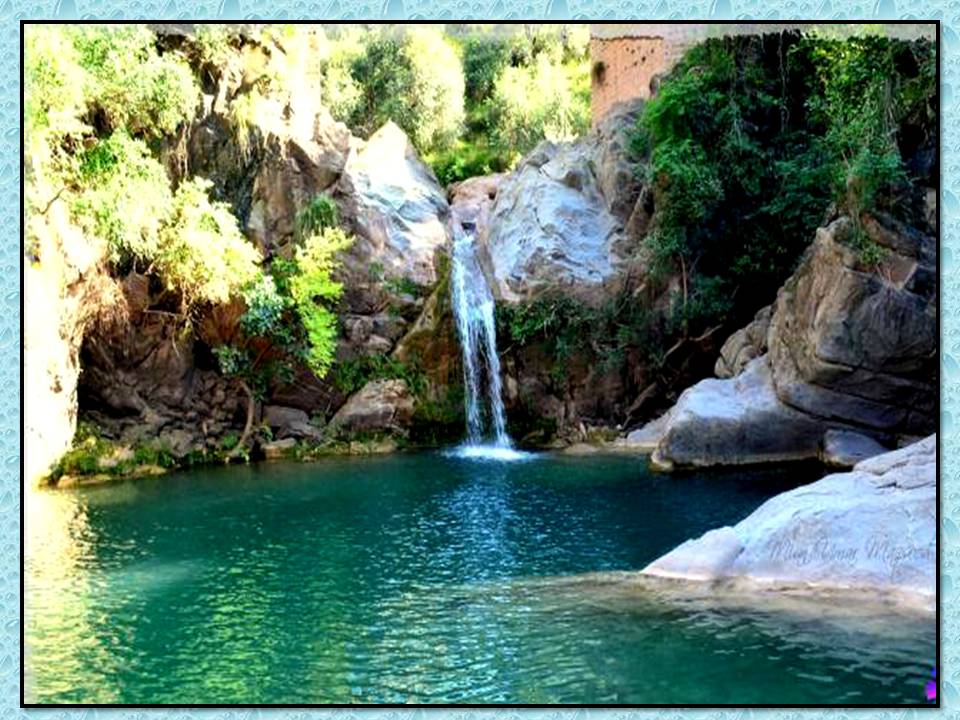
Neela Sandh is a place of series
of attractive natural ponds of crystal clear bluish water along lush green
valleys. There is waterfall, which is main attraction. This water fall, ponds and surrounding hills make
it worth a place to visit.
Neela Sandh is in a hilly area. There
is no a such modern technologyThere are huts after every
4 to 5 kilometers / their houses are mostly sheltered as sometime snow also
falls in that region.
Neela Sandh has pleasant climate. Mostly People speak Pahari, but Urdu and Punjabi languages are also used.People sources of earning include forestry and a bit of farming. Mostly they move toward Islamabad and Rawalpindi region in order to get jobs.
Tourist can visit this
place on personal transport like car,.bike or bus.
Friday, December 4, 2015
Sunday, November 29, 2015
Peaks of Pakistan
DISTAGIGHIL
SAR PEAK
Disteghil Sar or Distaghil Sar is the
highest mountain in the Hispar Muztagh, a subrange of the Karakoram mountain
range, in Gilgit-Baltistan. It is the 19th highest mountain on earth and the
7th highest peak in Pakistan. The mountain has an about 3 km long top ridge
above 7400m with three distinct summits: (north) west 7885m, central 7760 m,
and (south)east 7696m or 7535m
KANJUT SAR PEAK
Kanjut Sar is a mountain located in the Hispar Muztagh, a
subrange of the Karakoram mountain range. It lies within the Gilgit-Baltistan
province of Pakistan. It is the 26th highest mountain on Earth and the 11th
highest in Pakistan.
Kanjut Sar consists of two peaks:
Kanjut Sar I at 7,760 metres (25,459 ft).
Kanjut Sar II, to the south east of I, at 6,831 m (22,411
ft).
Friday, November 20, 2015
Chotiar Reservoir Lake
Chotiari Dam is
an artificial water reservoir It is locate 35 km away from Sanghar city in
the province of Sindh
Chotiari
lake has rich biodiversity and a junction complex of terrestrial and aquatic ecosystems of deep water, shallow marshes,
riverine forest, ephemeral channels, agriculture land and sand dunes Chotiari compassing north western flanks of
'Achro Thar' desert sand dunes that forms its north eastern & eastern
boundaries and images a consoling picture in contrast with quaint rainbow
beauty of charming hamlets with artistic cone-shaped straw cottages, encircled
with silken sand dunes and eastern edge of lower
Nara
Canal which forms its western and southern margins with an astonishing nature
view of riverine forest
and agriculture lands with colorful bird.
![]() |
| Nara Caaal |
Chotiari is a unique system of lakes, swamps, sand
dunes; the islands, old trees and wetlands in the adjoining patches 120 feet existed in the lakes. of Achro Thar, lower Nara canal and sand dunes elevated upto sand dunes elevated
upto 120 feet existed in the lakes.
It is also
wetland and habitation of birds, reptiles and small mammals.It was having a
significant population of Chinkara, Houbara, bustard, Desert cat, Fishing cat,
Caracal, Porcupine, Wild boar, Mangrove, Desert hare, Foxes, Jackal, wild ases
and Squirrels In the same sequence, it was considered a safe sanctuary for hog
dear, python and various extinct species and nesting & feeding grounds for
a variety of resident and enormous migratory Siberian birds, out of which
marbled teal was using it as breeding place. Chotiari has also a unique
opportunity to be the home place of Sindh warbler which is endemic to Sindh
Chotiari
Dam can be accessed from two different sides. One is to reach Jamrao Head, locally
called “Mundh Jamrao” which is approximately 80 km from Nawabshah city, and then take
road along with Ranto Canal, a tributary of Nara Canal to reach north embankment.
The second option is to go to Sanghar city and then reach Achro, the official
entrance of Chotiari reservoir.
Before the construction of reservoir this site was
home to few natural lakes were fed by tributaries of Nara Canal
The
main purpose of construction this dam is discharging saline water of Left Bank
Outfall Drain (LBOD). The dam is extended to 24300 acres with storage capacity
of 0.75 million acre feet
***********************************************************************
Tuesday, November 17, 2015
PIYALA LAKE {Kaghan Valley)
Pyala Lake is located in Kaghan Valley in the Khyber-Pakhtunkhwa province of Pakistan The word "Piyala" means "Bowl" in Pashto. It is located at an elevation of 3,410 metres (11,190 ft)
Subscribe to:
Posts (Atom)